The Konya regional Archaeological Survey Project (KRASP)
Early Metallurgy in the Hatti Heartland
Atsq’uri Project
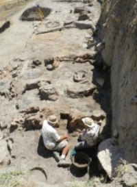
The Joint Georgian-Canadian Samtskhe Archaeological Expedition is supported by the Social Sciences and Humanities Research Council of Canada and the Archaeological Research Centre of the Georgian Academy of Sciences. Under the direction of Jacques Morin (emeritus of the Department of Archaeology) and Vakhtang Licheli (Georgian Archaeological Institute), excavations were conducted from 1993 to 1997 within the village of Atsq’uri, located on the upper course of the Mtkvari river – better known by its Russian name of Kura – which flows down from the Armenian plateau towards the Caspian Sea.
Gre Dimse
Norbert Karg excavated at Gre Dimse from 1999 through 2001.
Hacımusalar
Research in the plain of Elmalı and excavations on the mound of Hacımusalar, 17 kms. south of Elmalı in the central Lycian plateau of Turkey, were conducted between 1993 and 2014, under the direction of İlknur Özgen, emerita of the Department of Archaeology. In addition to team members from Bilkent’s Department of Archaeology, students and colleagues from several US-based institutions have also participated in the project.
Hacımusalar Höyük is a large rounded mound (300 x 350 m) whose occupation extended from at least the Early Bronze Age (4th millennium BCE) to the Byzantine period, with a gap in the Late Bronze Age (2nd millennium BCE), perhaps due to adverse environmental conditions. Ceramic finds of the Anatolian early Iron Age and Greek Archaic period indicate a reoccupation of the mound in the early 1st millennium BCE continuing without a break until the end of the 1st millennium CE. Epigraphic evidence suggests that Hacımusalar Höyük was the site of the ancient city of Choma, which became a member of the Lycian League in Roman times.
Excavations on the north edge of the mound have revealed elements of a substantial settlement of the Early Bronze Age: houses and one monumental structure paralleled at Karataş Semayük. On the east rim of the mound was excavated remains of a substantial Early Iron Age circuit wall whose rubble foundation and mud-brick superstructure are preserved to a height of several meters; the wall can be traced on the surface around the entire perimeter of the mound. Several trenches were opened on the flat summit of the mound, revealing some Hellenistic, Roman, and especially Late Roman and Byzantine occupation. Most outstanding among these were two Byzantine churches built from spolia originating from Roman era buildings, including several inscribed blocks. Finally, in the last two seasons excavations were begun at the base of the mound on its south edge. Evidence suggests the presence there of the civic centre of the Roman city: a 100 m long retaining wall, a second wall parallel to it 35 meters to the south, an elevated terrace, and a large putative bath establishment beyond the mound further south.
For more information: Özgen, İ. & Baughan, E., 2016: “Hacımusalar Höyük / Choma Erken Tunç Devri’nden Bizans Dönemi’ne Kuzey Likya’da Bölgesel Bir Merkez – Hacımusalar Höyük / Choma. A Regional Center in Northern Lycia, from the Early Bronze Age to the Byzantine Era”, in İşkan, H. & Dündar, E., Lukka’dan Likya’ya Sarpedon ve Aziz Nıkolaos’un Ülkesi – From Lukka to Lycia the Land of Sarpedon and St. Nicholas (Istanbul: Yapı Kredı Yayınları): 318-335.
Kinet Höyük
Kinet Höyük, located in southeast Cilicia on the seacoast at Yeşilköy, Dörtyol (Hatay), was an ancient harbor town inhabited more or less continuously from the sixth millennium BC until the early first century BC, and then again, after a long gap, from the mid 12th to the early 14th century. It has been identified with Pre Sargonic Ama, Hittite Izziya, and classical Issos, the city near which Alexander the Great defeated the Persian king, Darius III, in 333 BC. Excavations were carried out at the site from 1992 to 2012 by the Department of Archaeology, Bilkent University, under the direction of Marie – Henriette Gates. Other sites in the vicinity explored under the aegis of the Kinet Höyük project include a partly preserved late Roman bridge and a fortified settlement of medieval date, mid-8th to early 12th centuries, identified as Hisn al-Tinat. The field seasons ended in 2012; research and publication activities have continued ever since. (A link to the bibliography of the site is given below.)
The Kinet Höyük project has been fundamental in expanding the archaeological record of the
northeastern Mediterranean. Excavations from this small but well-connected seaport produced excellent stratified contexts from a long sequence, with multiple contacts beyond its immediate cultural region. In all periods, Kinet’s cultural assemblages have proved to be sensitive indicators for the forces that shaped the Mediterranean’s economic currents over these many centuries. Of particular interest is evidence for change during the many centuries of occupation. The sea was crucial. Kinet was tied to an economic network that usually extended as far as Cyprus, and occasionally throughout the eastern Mediterranean. On occasion, however, the residents showed little interest in the sea, focusing instead on the land as the basis of their subsistence.
Late Neolithic habitation is attested through random finds of Halaf potsherds. Excavated architectural levels begin only later, in the Early Bronze II period, in the third millennium BC. From the final centuries of the Middle Bronze Age, 18th-16th centuries BC, a monumental building of palatial character was partly exposed on the east side of the mound. Destroyed in a fire that preserved its mudbrick walls to a height of 2 m, this building yielded several hundred ceramic jars from its storerooms and industrial quarters. During the Late Bronze Age, 16th-13th centuries BC, the town was controlled by the Hittites, with ceramics a key indicator of its connection with the Hittite heartland in central Anatolia.
The lengthy sequence of Iron Age occupation saw an urbanized rise in the 9th century BC replaced by a Neo-Assyrian settlement in the 8th century BC. This in turn was destroyed, to be followed by a town with a firm orientation toward the sea, with a predilection for Aegean ceramic styles popular throughout the Levant and a thriving purple dye industry. In the 6th century BC, the Achaemenid Persians took control of Cilicia. Kinet Höyük prospered in the 5th and 4th centuries BC, its harbors surely valued for their strategic location for the Persian military forces in a time of unrest in the eastern Mediterranean territories. The town continued for a few centuries after the conquest of Alexander, but on a smaller scale. In the early first century BC, habitation came to an end, the result, it is thought, of the filling in of the harbors by erosion from the nearby Amanus Mountains. The site was no longer commercially viable.
After an interval of over 1000 years, the site was resettled by Crusaders in the mid-12th century. As a hill with a commanding view over the coastal plain, Kinet now had strategic value. The medieval citadel, made of mudbrick on stone foundations, would be rebuilt three times until its abandonment in the mid-14th century when the Mamluks took control of the region.
Here you can find the full list of the publications about Kinet Höyük.
Roman Gordion
This project, directed by Dr. Andrew Goldman, of the Gonzaga University History Department (Spokane), with Julian Bennett of Bilkent among his assistants, is devoted to exploring the Roman Imperial levels at Gordion.
Tihau
The Tihau Excavation Project is jointly directed by Julian Bennett of Bilkent University and Coriolan Opreanu, of the Institute of Archaeology, Cluj-Napoca, and will begin in 2005. The objective is to excavate, over a five-year period, about one sixth of the fort’s total area, to resolve three principal questions concerning the site and its immediate region.